|
|
|
|
Some Smiths |
|
|
|
Canmore City RideCanmore, AlbertaDirections:Our friends live on Prospect Heights, so we start the ride from there. That results in a 14km long out and back ride if you go South-East, or a 21km loop if you go North-West. There is ample parking along the street with easy access to the trail. There are many other places to join the route, but parking might be a problem if you started in town. Conditions:The route is a combination of paved and unpaved trails and city streets, most of which are not very busy. All of the route is on easy to ride surfaces that for the most part require single file riding. The Trip:Starting at Prospect Heights, follow the route to get on the Three Sisters Pathway. South-East
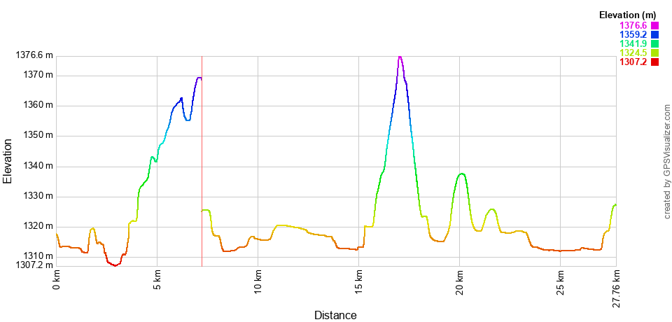
A small warning for inexperienced cyclists: there is a hill to climb when the path finally leaves the river valley which includes some fairly tight switchbacks. It may be necessary for some to dismount to navigate some of the turns. The return is on the same route. North-West From Prospect Heights, turn left on the Three Sisters Pathway. Follow the river until it reaches the northern most point on the route and then follow the trail back along the Canmore Golf and Curling Club golf course. Carry on through the main part of the city on bike paths through Spring Creek Mountain Village, and then on city streets until you reach the path up the Cougar Creek pathway. Turn left on to Benchlands Trail and follow it and then the TransCanada Highway until you turn left at Bow Valley Trail to cross the highway back. The remaining route is on city streets until you get back to the Three Sisters Pathway to return to the starting point. Map:Here is a map of the route on Google Maps with a link to the .gpx file: Canmore City Ride Elevation ProfileThis 35km round trip route has many ups and downs, but much of the route is relatively flat, with a couple 50 meter (4%) hills.
|
|
